When publishing an image service, the REST image service is the Server Type published by default. The REST Service interface provides a variety of service resources. You can view the Tile scheme and other related information of the image service in the following ways.
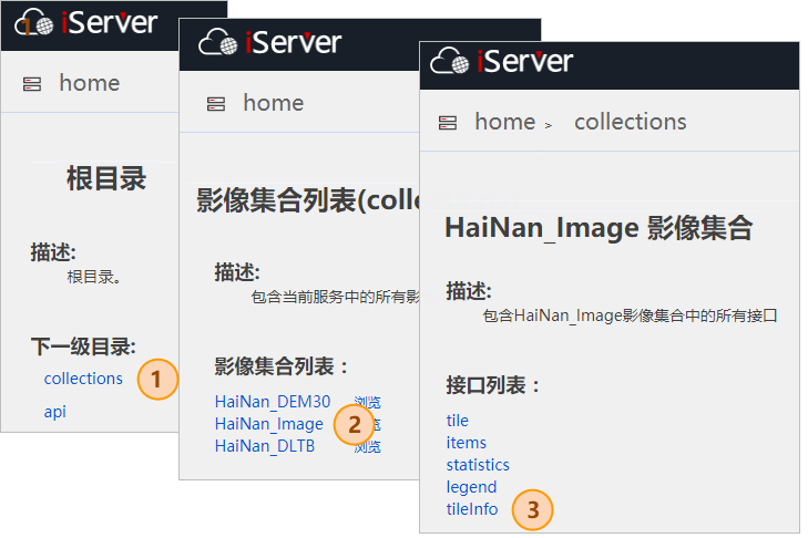
1. Access to REST imaging services such as http://localhost:8090/iserver/services/imageservice-HaiNan/restjsr.
2. Click "collections"; click the name of image collection, such as "HaiNan _ Image" "; click" tileInfo ".
3.Enter the "tileinfo" description page of the collection, as shown in the following figure:
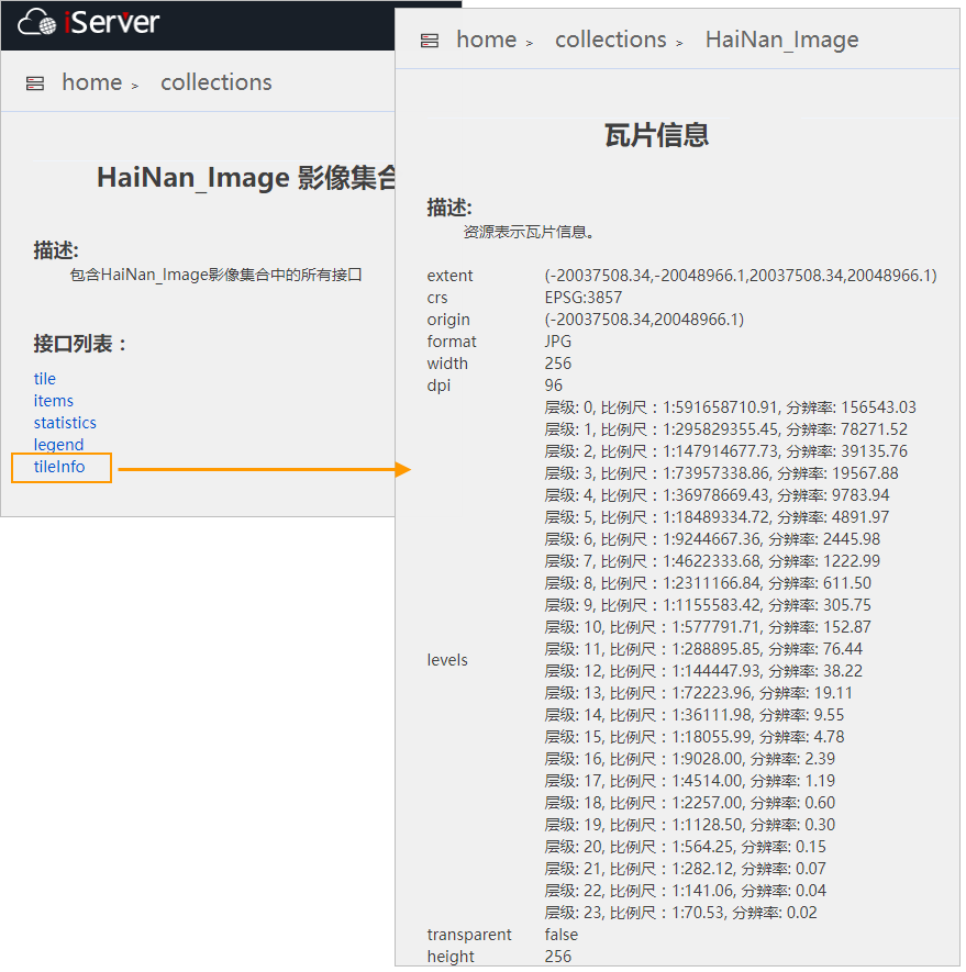
The following describes the specific content of this page:
- extent: the geographic range of the tile service, which is the geographic range of the image collection.
- crs: the coordinate system of the tile service, that is, the coordinate system of the image collection.
- orgin: the GCS origin of the tile service, which is the upper left corner, in the format of: (X coordinate, Y coordinate).
- format: tile format, JPG, PNG and WEBP are supported.
- width/height: the width/height of the tile, in pixels. Currently, only tile sizes with a width/height of 256 pixels are supported.
- levels: the level of the tile, the scale corresponding to the level, and the calculated resolution.
The tile grid division of the image service is based on the Global of the image collection coordinate system. The X index (column number) starts from the top left corner of the Global, the index number is 0, and increases from left to right; the Y index (row number) starts from the top left corner of the Global, the index number is 0, and increases from top to bottom; The Z index (level) uses the level of the Global rule, starting from 0, corresponding to the scale bar: 1: 591658710.909132.
Resolution: The value is in meters, calculated based on the EPSG 3857 projection, and represents the actual ground distance represented by a pixel.
- transparent: whether the Tile is background transparency. Tile in PNG and WEBP formats supports Background Transparency.
- dpi: tile's DPI.
Tile info of image collection: It is derived from its collection information and the tile scheme configured. The default value is as follows:
- extent: defaults to the Geographic Range of the image collection and does not support modification.
- crs: defaults to the coordinate system of image collection and does not support modification.
- orgin: Defaults to the top left corner of the image collection.
- format: The default is JPG.
- width/height: default width and height values are both 256 pixels.
- levels: The default minimum level is 0 and the maximum level is 23.
- transparent: Default is Background Transparency.
- dpi: Default is 96.