When publishing an image service, the REST image service is the Server Type published by default, and the REST Service interface provides multiple service resources.
For example, the access address of the REST image service is http://localhost:8090/iserver/services/imageservice-HaiNan/restjsr.
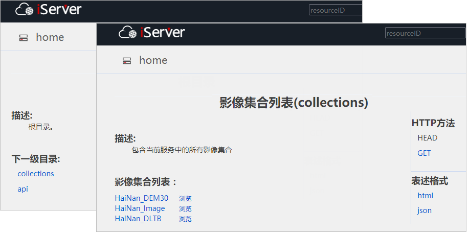
View image collection List
Access the REST image service, such as http://localhost:8090/iserver/services/imageservice-HaiNan/restjsr, enter the root directory of the image service, and click "collections". Enter the image collection list, where all collections in the current service are listed.
Click the "Browse" button on the right side of the image collection name to browse the dynamic mosaic results of the collection image.
Click the image collection name to further view other data information for the collection.
View image file list
Click a collection name on the image collection list page to enter the resource page of the collection, and then click "items" to enter the Image file list, where the File Names of all images in the collection are listed.
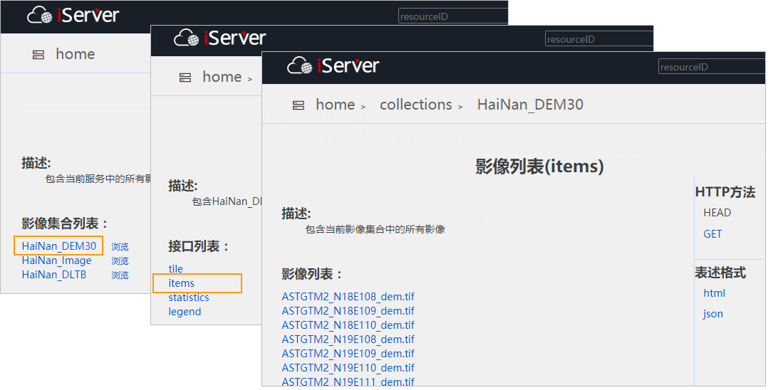
Click the name of image files to enter the image information page.
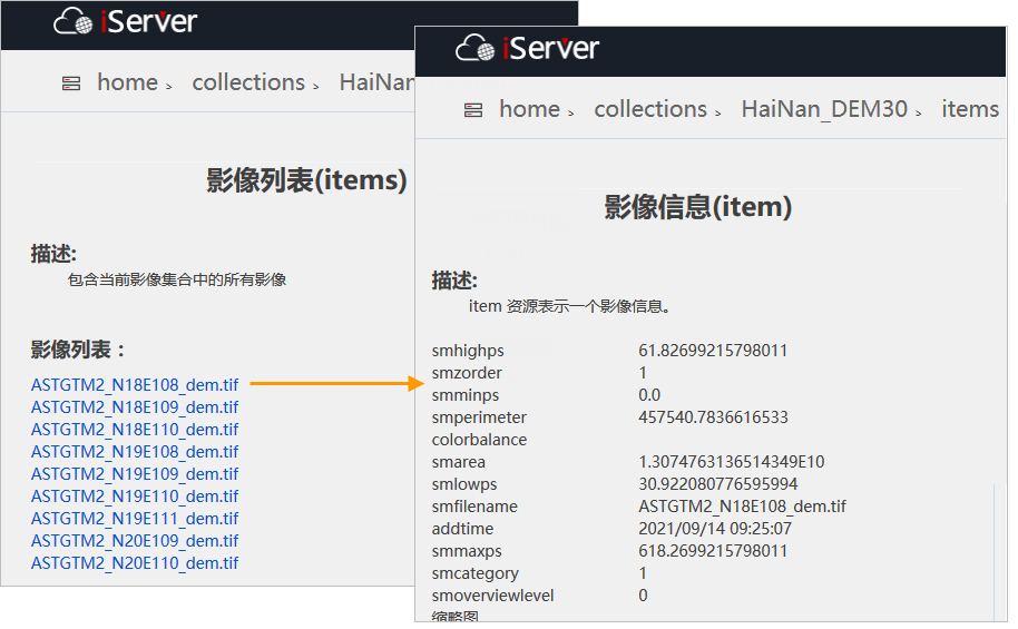
View image file Info
The image information page, as shown in the figure above, displays the meta data information of image files, and the format is: field name of the stored information + corresponding value.
The fields are described as follows:
- smfilename: The file name of image files, including the file extension.
- smminps/smmaxps: Smminps/smmaxps is calculated from smlowps/smhighps. These two values are used to control the resolution of the grid used to create the dynamic mosaic image when the image is displayed. Generally, the value of smminps is 0, and the value of smmaxps is smhighps * 10. For example, if smlowps = 8m and smhighps = 16m, then smminps = 0 and smmaxps = 160. The unit of smminps/smmaxps is the map unit. If the map is a longitude and latitude coordinate system, the unit of value is degrees. If the map is a Projected Coordi Nate System, the unit of value is meters. When mosaic dataset is displayed, especially at small scales, the image is not displayed when the resolution of the current display grid is greater than smmaxps value.
- smlowps/smhighps: Read from Raster Data to define the minimum and maximum resolution that Raster Data contains. The unit of the data value is different according to different image coordinate systems. For the longitude and latitude coordinate system, the unit of the data value is degree; for the Projected Coordinate System, the unit of the data value is meter. For example, the multispectral band resolution of Gaofen-1 is 8 meters, the panchromatic band resolution is 2 meters, and the smlowps/smhighps values are equal without pyramids; When there is a pyramid, the smlowps value is the base resolution, and the smhighps represents the resolution of the top pyramid pixel. Therefore, for the multi-spectral band of Gaofen-1, the base resolution is 8 meters, and the top pyramid pixel resolution is 16 meters; for the panchromatic band, the base resolution is 2 meters, and the top pyramid pixel resolution is 16 meters.
- smarea: Area of the Geographic Range covered by the current image, in meters.
- smperimeter: The perimeter of the area covered by the current image. The unit is meter.
- cloud percent: The amount of cloud coverage for Satellite Image.
- producetime: The generation time of the Satellite Image.
- sensorid: Sensor information of the Satellite Image, whose value is the sensor ID.
- thumbnail: Thumbnail of the current image content in the image Default Display style.
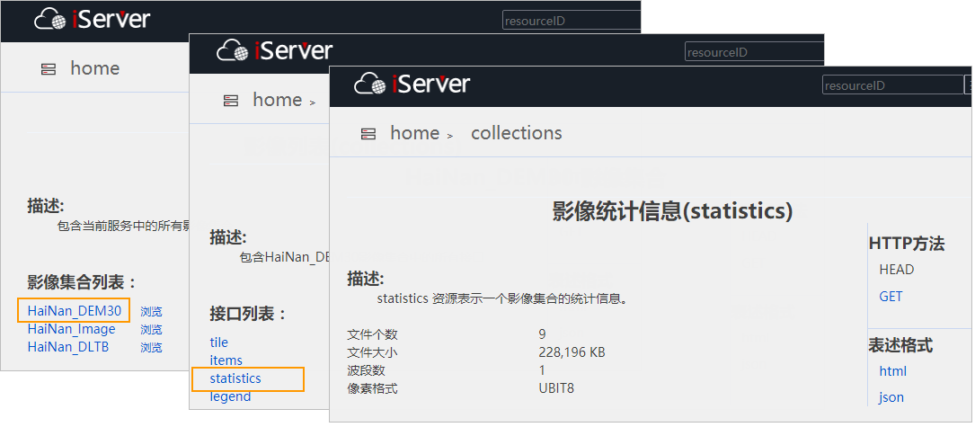
View image collection statistic info mation.
Click a collection name in the image collection list to enter the collection resource page; Click "statistics" again to view the statistic infomation of the current collection, including the total number of image files, the size of image files, the pixel format of image files, the number of image bands, etc. Where the image files size is the total size of the.tif or.img or.ecw image files in the collection, excluding the size of subsidiary files such as pyramid files.