When publishing the image service, the REST image service is the Server Type published by default, and the REST Service interface provides multiple service resources; the grid information of the Specify Coordinates location can be queried through the REST Service interface.
For example, the access address of the REST image service is http://localhost:8090/iserver/services/imageservice-chinatif/restjsr.
1.Access to REST imaging services, such as http://localhost:8090/iserver/services/imageservice-chinatif/restjsr;
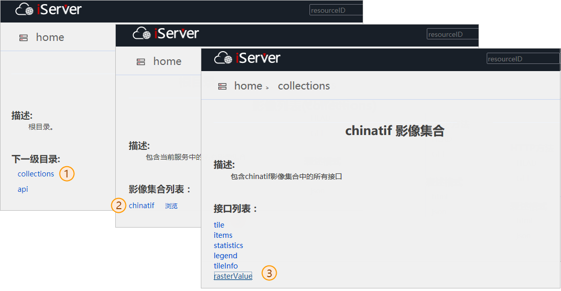
2. On the root directory page of image service, click "collections" to enter the image collection list page; click a collection, such as "chinatif", and click "rasterValue" to enter the rasterValue request page.
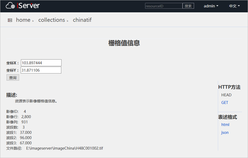
3.On the rasterValue request page, specify the coordinates of the grid to be queried through coordinates X and Y, and then click "Query" to return the grid value of the coordinates and related information, as shown below.