Create Buffers |
Create Buffers refer to create buffer polygons around input features to a specified distance. The specified distance refers to the buffer radius, it can be a fixed numeric value or can be a numeric type of field.
iServer supports to create buffers for two-dimensional point, line and region datasets. The third column of the following pictures shows the results when setting the dissolve field.
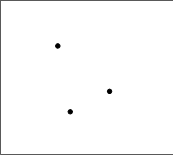
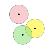
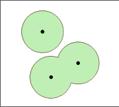
Point dataset:
Point Point Buffer Set the Dissolve Field
Line dataset:
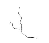
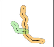
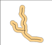
Line Line Buffer Set the Dissolve Field
Region dataset:
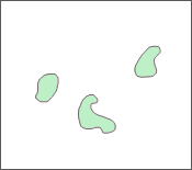
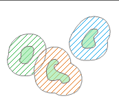
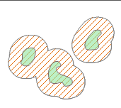
Region Region Buffer Set the Dissolve Field
Source dataset: used to specify the dataset to be buffered, required. The buffers resource page in iServer automatically lists all the datasets that meet the analysis conditions.
Analysis bounds: optional. Defaults to the full extent of the input dataset.
Buffer distance: optional. Defaults to 10.
Buffer distance field: optional. If this parameter is set, the above buffer distance is invalid.
Distance unit: defaults to Meter. Options values: Meter, Kilometer, Yard, Foot, Mile.
Dissolve field: optional. Used to dissolve the result buffer regions based on the specified field.